
 Photo: Chabe01 ↗
THE JOURNEY IN DETAIL
Europe’s toughest waymarked trek.
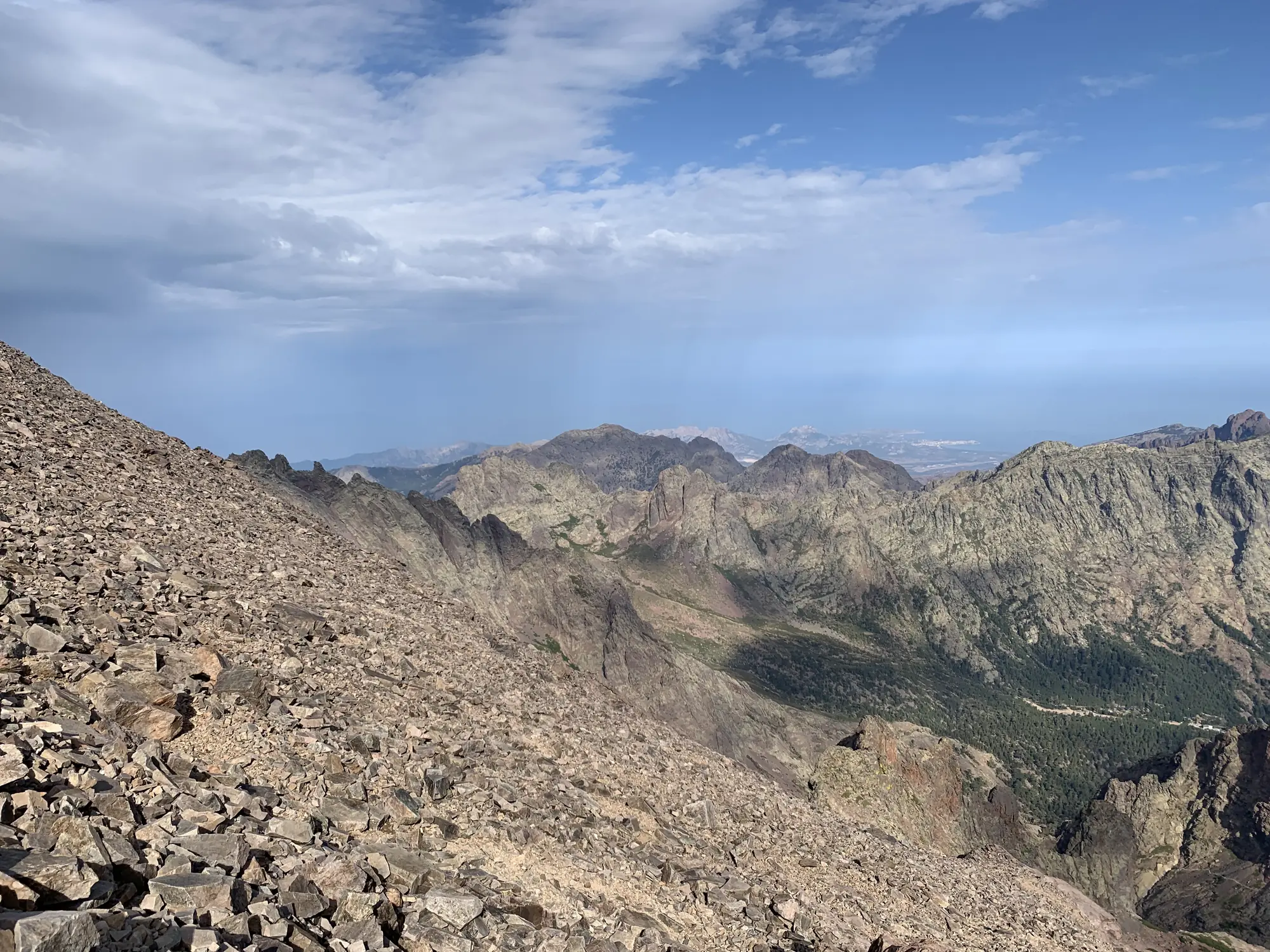
The GR20 crosses Corsica along its granite spine from north-west to south-east and is rightly called the hardest waymarked trail in Europe. Flat ground barely exists: every day means slabs, chains on the steeper steps and around a thousand metres of height gain. We walk the full Calenzana to Conca line in twelve walking days, sleeping in the national park refuges.
- The full Calenzana to Conca line
- Granite slabs and chains in the Cinto massif
- Lakes Nino and Melo at first light
- Park refuges with Corsican cooking
With old friends or new ones
Join a group or arrange a separate departure for your own team. Before travelling, we get to know each other, discuss everyone's experience and find suitable dates. You can also prepare together.
DAY BY DAY
Your daily itinerary.
A provisional itinerary. Weather, group readiness and local conditions may change the order and length of the stages.
- DAY 1 · Transfer and briefing
Calvi, briefing and start in Calenzana
We meet in Calvi, weigh the packs and drive to Calenzana at 275 m. An evening briefing on water, weather and pace: on the GR20 you leave at six to stay ahead of the heat.
Overnight: Guesthouse in Calenzana - DAY 2 · 12 km, 1,400 m of ascent
Calenzana to Ortu di u Piobbu
The most honest of introductions: 1,400 m of ascent through maquis and rock over six or seven hours. The refuge sits at 1,570 m looking back to the bay of Calvi.
Overnight: Refuge Ortu di u Piobbu, 1,570 m - DAY 3 · 8 km, 750 m of ascent
To Carrozzu via the Mulinello
A rocky traverse with chains and a descent into the Spasimata gorge. Short in kilometres but six hours long, because the hands are in use almost constantly.
Overnight: Refuge Carrozzu, 1,270 m - DAY 4 · 9 km, 900 m of ascent
The Spasimata bridge and Asco
We cross the famous suspension bridge, climb to Bocca Muvrella at 2,020 m and drop into the Asco valley. In the evening a shower and the first proper meal in three days.
Overnight: Asco Stagnu, 1,422 m - DAY 5 · 10 km, 1,000 m of ascent
Around Cinto to Tighjettu
A climb past Pointe des Eboulis to the col at 2,183 m below Monte Cinto, at 2,706 m the highest point of Corsica. A scree descent leads to Tighjettu refuge.
Overnight: Refuge Tighjettu, 1,683 m - DAY 6 · 17 km, 800 m of climbing
Castel de Vergio via Ciottulu
A long day past Ciottulu di i Mori at 1,991 m, where the river Golo is born. By evening we enter the Valdo-Niello pine forest and sleep at the hotel by the Vergio pass.
Overnight: Hotel Castel de Vergio, 1,404 m - DAY 7 · 15 km, 600 m of climbing
Lake Nino and the Camputile plateau
The gentlest stage on the route: Lake Nino at 1,743 m, ringed by peat pozzines where horses graze. We finish at Manganu, the highest refuge on the GR20.
Overnight: Refuge Manganu, 1,601 m - DAY 8 · 11 km, 900 m of climbing
Breche de Capitellu and the lakes
The high point of the north: the Breche de Capitellu at 2,225 m, the highest point on the trail, with lakes Melo and Capitello below. Then a ridge traverse to Petra Piana.
Overnight: Refuge Petra Piana, 1,842 m - DAY 9 · 10 km, 700 m of climbing
The ridge variant to Onda
We take the high ridge variant, with both coasts of the island in view for hours. In the evening we drop to Onda at 1,430 m and get ready for the long stage to Vizzavona.
Overnight: Refuge Onda, 1,430 m - DAY 10 · 12 km, 600 m of ascent
Monte d’Oro flank and down to Vizzavona
A climb to Bocca Porcu at 1,950 m under the walls of Monte d’Oro, 2,389 m, then a long forest descent to Vizzavona station. This is where the northern half officially ends.
Overnight: Hotel in Vizzavona, 920 m - DAY 11 · 22 km, 1,000 m of ascent
Into the south: Col de Verde
The southern stages are gentler underfoot and longer in kilometres. We pass Capannelle and beech woods to the Col de Verde at 1,289 m, with a swim in the Fiumorbo on the way.
Overnight: Refuge Col de Verde, 1,289 m - DAY 12 · 23 km, 900 m of ascent
The Bavella needles and the finish at Conca
A last long day through the red towers of the Aiguilles de Bavella and Paliri refuge, then a maquis descent to Conca at 252 m. The finish marker, the sea nearby and a transfer to Porto-Vecchio.
Overnight: —
Included in the estimated price
Eleven nights: park refuges and mountain inns
Half board on the trail, dinners at the refuges
A club mountain guide, a second from six people
Refuge bookings through the park system
Transfers from Calvi and from Conca to Porto-Vecchio
Hotel in Vizzavona on the rest day
Group first-aid kit and satellite beacon
Not included in the price
Flights to the meeting point
Personal travel insurance and visas
Personal equipment
Single-room supplements and personal expenses
Lunches and trail food
Sleeping bag and liner hire
Drinks at refuges and baggage transfer
YOUR PREPARATION
Arrive ready for the route.
This is a route for experienced walkers: two or three multi-day mountain trips behind you, no fear of exposure and the willingness to carry 9–11 kg. Ivan runs a four-month build-up — long days on rocky ground and compulsory descent training.
Prepare with IvanROUTE QUESTIONS
BEFORE WE MEET ON THE TRAIL
What to prepare in advance
- Broken-in trekking footwear and a suitable daypack
- Rain gear, an insulating layer and spare socks
- Poles, if you are used to them
- Personal items within the agreed luggage allowance and suited to the accommodation
Once we choose a date, we agree on the equipment list, meeting point and transfer time. Please wait until the programme is confirmed before booking flights.