
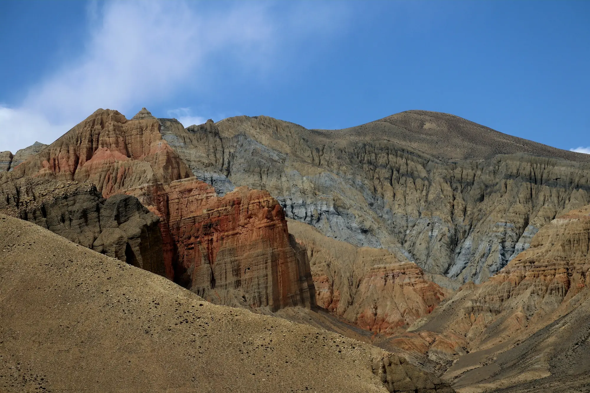
 Photo: Rijan Gurung ↗
THE JOURNEY IN DETAIL
On foot into the walled kingdom.
Upper Mustang lies in the rain shadow of Annapurna and Dhaulagiri, which is why people come in summer while the monsoon drowns the rest of Nepal. Culturally and linguistically Tibetan, it is a plateau of cave monasteries and a walled capital, Lo Manthang. A restricted zone: a guide and a special permit are compulsory.
- The walls and palace of Lo Manthang
- The Chhoser caves and Nyiphu monastery
- The red cliffs of Dhakmar and Ghami
- A summer trek while Nepal is under monsoon
With old friends or new ones
Join a group or arrange a separate departure for your own team. Before travelling, we get to know each other, discuss everyone's experience and find suitable dates. You can also prepare together.
DAY BY DAY
Your daily itinerary.
A provisional itinerary. Weather, group readiness and local conditions may change the order and length of the stages.
- DAY 1 · Permits and briefing
Kathmandu and the restricted zone paperwork
We meet in Kathmandu and hand over passports for the Upper Mustang permit, which is issued only through an agency and only for groups of two or more. An evening briefing on the rules of a restricted area.
Overnight: Hotel in Kathmandu - DAY 2 · Transfer and packing
Pokhara and preparation
A flight or drive to Pokhara (820 m). We buy what is missing and pack duffels for the horses: in Mustang loads often travel on pack animals rather than porters. An early night before the morning flight to Jomsom.
Overnight: Hotel in Pokhara - DAY 3 · 10 km along the river
Flight to Jomsom, walk to Kagbeni
A twenty-minute flight between Annapurna and Dhaulagiri into Jomsom (2,720 m). Then 10 km up the Kali Gandaki riverbed to Kagbeni (2,800 m), the medieval village at the gate of the restricted zone.
Overnight: Guesthouse in Kagbeni - DAY 4 · 18 km, 860 m of ascent
Kagbeni to Samar
A checkpost on the way out of Kagbeni, and Upper Mustang begins. We follow the right bank of the Kali Gandaki through Tangbe and Chhusang, then climb steeply from Chele to Samar at 3,660 m. Around 18 km.
Overnight: Guesthouse in Samar, 3,660 m - DAY 5 · 20 km, three passes
Passes to Ghami
The most broken day of the trek: three passes, Bhena La (3,860 m), Yamda La (4,010 m) and Nyi La (4,010 m), with full descents between them. We sleep at Ghami (3,520 m) below the red cliffs of Dhakmar.
Overnight: Guesthouse in Ghami - DAY 6 · 15 km, a 3,870 m pass
The Ghami mani wall and Tsarang
Just outside the village stands Nepal's longest mani wall, some 300 metres of it. Over the Tsarang La (3,870 m) we reach Tsarang (3,560 m), with its palace and fourteenth-century monastery and its library of Tibetan manuscripts.
Overnight: Guesthouse in Tsarang - DAY 7 · 14 km, the Lo La
Entering Lo Manthang
From the Lo La (3,950 m) Lo Manthang appears for the first time, a square of mud-brick walls on a 3,840 m plain. We enter through its single gate and stay inside the walls. Around 14 km.
Overnight: Guesthouse in Lo Manthang, 3,840 m - DAY 8 · A day of sightseeing
The monasteries of the capital
A day inside the walls: Jampa Lhakhang with its fifteenth-century mandalas, Thubchen and Chode gompas, and the four-storey palace of the raja. In the afternoon a walk up the hill above town for the wider view.
Overnight: Guesthouse in Lo Manthang - DAY 9 · 18 km out and back
The caves of Chhoser
A day trip north towards the Tibetan border: the five-storey cave village of Jhong with ladders cut into the rock, and the cave monastery of Nyiphu. Some 18 km there and back, with modest ascent.
Overnight: Guesthouse in Lo Manthang - DAY 10 · 19 km, a 4,080 m pass
The eastern path to Yara
We return by the eastern variant rather than retracing our steps, going through Dhi and the Puyung valley. The Dhi La tops out near 4,080 m and we sleep in Yara (3,650 m), looking out over the canyons.
Overnight: Guesthouse in Yara - DAY 11 · 20 km across the plateau
Luri gompa and on to Tangge
A morning detour on foot to Luri gompa, a chorten inside a rock cavity painted in the fourteenth century. Then a long stage across the plateau to Tangge (3,240 m), into the afternoon headwind.
Overnight: Guesthouse in Tangge - DAY 12 · 22 km, a 4,230 m pass
A 4,230 m pass and Tetang
The high point of the route: a long climb to an unnamed pass near 4,230 m above the Tangge canyon, then a drop into Tetang (3,040 m), a village tucked out of the wind in a fold of the hillside.
Overnight: Guesthouse in Tetang - DAY 13 · 16 km and a transfer
Out to Jomsom
The last walking day: through Chhusang to Kagbeni and on down the Kali Gandaki to Jomsom. If the wind is strong we take a jeep for part of it. Dinner and a gear hand-back in the evening.
Overnight: Lodge in Jomsom - DAY 14 · Flight, transfer
Flight to Pokhara, departure
The morning flight to Pokhara: aircraft work the Kali Gandaki only before noon, before the wind gets up. From there a transfer to the airport or to a hotel, as you prefer.
Overnight: —
Included in the estimated price
Teahouses and guesthouses on the route
Hotels in Kathmandu and Pokhara, breakfast
Three meals a day on the trek
A licensed guide, compulsory in the restricted area
Upper Mustang restricted permit and ACAP permit
Porters and pack horses on the longer stages
Pokhara — Jomsom flights both ways
Not included in the price
Flights to the meeting point
Personal travel insurance and visas
Personal equipment
Single-room supplements and personal expenses
Kathmandu — Pokhara flight
Entry tickets to the Lo Manthang monasteries
Hiring a horse to ride, about €40 a day
Single supplement
YOUR PREPARATION
Arrive ready for the route.
Nothing technical, but the days are many and the afternoon wind wears you down more than the gradient. Ivan builds the preparation around long easy four- to five-hour outings and suggests getting used to walking in a buff and dust glasses.
Prepare with IvanROUTE QUESTIONS
BEFORE WE MEET ON THE TRAIL
What to prepare in advance
- Broken-in trekking footwear and a suitable daypack
- Rain gear, an insulating layer and spare socks
- Poles, if you are used to them
- Personal items within the agreed luggage allowance and suited to the accommodation
Once we choose a date, we agree on the equipment list, meeting point and transfer time. Please wait until the programme is confirmed before booking flights.